
 5 months Ago
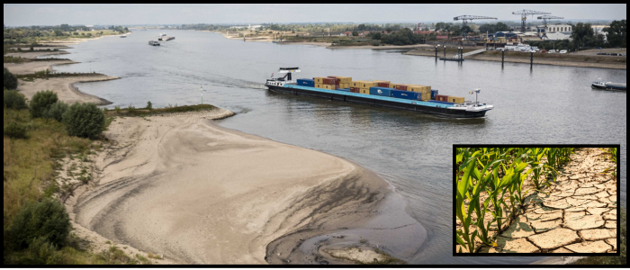
The start of 2024 was already arid. While May offered a brief respite, with 60-80mm of rain falling in the northwest and southeast, and 20-40mm in the southwest, those improvements are swiftly being undone. "The combined sun, heat and dryness coming our way is going to drive the deficit up pretty fast," experts say.
Heatwave Ratchets Up, Water Runs Short
The current shortfall in rainfall is about 130 mm, which falls into the lowest 5% of all years for which we have records dating back to 1910. Forecasts indicate the deficit could rise rapidly to be close to the record levels observed in 1976 by 21 June.
It's going to gradually get a bit warmer the next few days. Today's highs will be from 20 degrees along the north coast to 28 degrees in the southwest. Skin can burn in just 10 minutes with a moderate westerly wind and strong sunshine – so don't forget to pack the sunscreen.
On Wednesday, conditions will stay warm, cool off a bit on Thursday (19°C to 23°C) and rise again by the weekend. On Saturday, tropical temperatures may exceed 30°C, especially in the south-east.


